Residents invited to public workshop about local neighbourhood plan for Gordon’s Bay Development Area
15 August 2023
The City of Cape Town is busy preparing a local spatial development framework (LSDF), or neighbourhood plan, for the Gordon’s Bay Development Area in the Helderberg District. We are hosting a public workshop on 22 August 2023, and residents and interested parties are encouraged to attend this very important meeting.
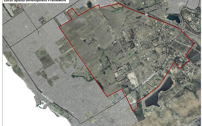
'The Gordon's Bay Development Area (GBDA) concerns vacant underdeveloped land situated to the north of the coastal town, between the existing N2 highway and just east of Sir Lowry's Pass Road. The process that is currently under way gives residents the opportunity to influence the development vision for this area which is one of the biggest parcels of vacant land within the city's borders,' said the City's Deputy Mayor and Mayoral Committee Member for Spatial Planning and Environment, Alderman Eddie Andrews.
The public workshop is taking place as follows:
- Tuesday, 22 August 2023
- From 17:00 to 19:00
- At the Strand Town Hall, Piet Retief Street, Strand
'At this workshop residents and City officials will get together to discuss burning questions, brainstorm ideas and proposals, identify challenges concerning this area, and collaborate on proposed solutions. Our local residents have first-hand experience of the area, and this is why we need input from those living in close proximity to the GBDA. By collaborating with the City our residents will also get a better understanding of how we develop a local spatial development framework, and how they can get involved to influence this process,' said Alderman Andrews.
A local spatial development framework, or LSDF, determines the development vision for an area on a local level. The City uses the LSDF for guidance when making decisions about development applications and land uses; and in the end, these decisions very much determine what a neighbourhood will look and feel like, a few years down the line.
'The GBDA has immense development potential and includes Vlakteplaas, where the City will develop housing, as well as Firlands. Apart from development pressures stemming from population growth, the intended LSDF must also take into account the upgrade of the Sir Lowry's Pass River corridor, and Sanral's intentions to realign the section of the N2 freeway that borders the area.
'The City's view is that as much as we need development to keep up with population growth demands, this must be managed in a sustainable manner that promotes and protects the unique characteristics of the area. In this sense, we want to collaborate with residents and affected parties in the drafting of the LSDF that will guide future decisions on how this land should be used, developed, and importantly, how the natural environment should be protected,' said Alderman Andrews.
For more information:
The public's contributions will be used to finalise the draft LSDF and thereafter it will be advertised for public comment, and further refinement.
The LSDF for the Gordon's Bay Development Area will elaborate on and support the spatial development guidelines as set out in the Helderberg District Spatial Development Framework, which is a higher order spatial plan for the greater Helderberg area.
Caption: The City is collaborating with residents and interested and affected parties in the drafting of the local spatial development framework, or neighbourhood plan, for the Gordon's Bay Development Area – as indicated in the map. Residents are encouraged to attend the workshop at the Strand Town Hall on 22 August 2023.
End
Published by:
City of Cape Town, Media Office